This section provides guidance on how to create well-designed neighbourhoods and subdivisions to ensure that quality residential growth and sustainability outcomes are delivered for Auckland.
Mahere Rangatira Neighbourhood and subdivision design
1. Introduction
This guidance describes how to create well-designed medium to large scale urban residential subdivisions and neighbourhoods.
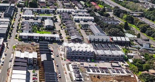
The way a neighbourhood or subdivision is designed is fundamental to its quality and character. Once a street pattern is formed and land is subdivided, a long-term urban form is created that is very difficult to change.
This practice is vital to building neighbourhoods where residents experience a good quality of life, and paves the way for high-quality residential growth and sustainability outcomes for Auckland's greenfield and brownfield areas.
This guidance is organised around:
- Natural environment
- Movement networks
- Use and activity
- Structure and identity
For each element, there is a Design outcome that every subdivision should aim to achieve. Other sections of the Auckland Design Manual also contain guidance relevant to subdivision design, especially the housing and park design sections.
A design statement is a useful tool for informing the design of a proposed neighbourhood or subdivision.

2. Natural environment
Auckland is defined by a range of natural landforms and environments. Our mountain ranges and coastlines, our areas of dense native bush and our wide pastoral plains all help make Auckland unique.
All development brings with it a responsibility to respond carefully to the attributes of a site and its surrounds, ensuring that development enhances the characteristics of the site and contributes to Auckland's celebrated natural environment.
2.1 Landform features and topography
Design outcome:
Subdivision responds to the landform and its features, and minimises any changes if needed.
Why do this?
Auckland has a unique and internationally significant natural environment that is a result of many interacting geological processes. This has resulted in a wide choice of living options for Aucklanders, from flat and well connected, to elevated and outlook based. Subdivisions should celebrate and reflect these differences instead of hiding or removing them.
The most important features of a site should influence the subdivision design. This means that very sloping land will not suit a flat-site-based development, and a development that wants to capitalise on views will not suit a flat plain. For both landform scenarios the designer/developer should anticipate different residential amenities and design accordingly.
How to achieve this outcome:
- Undertake all earthworks at one time, instead of leaving lots that need further earthworks before they can be developed.
- Undertake significant environmental changes only when necessary to protect human health and safety, or when focusing works and activity into one part of a site will be better for the environment overall.
- Aim for changes to sloping land to appear as ‘natural’ as possible. Try not to create straight vertical or horizontal planes that stand out when looking at the site.
- Include space for planting and vegetation to soften the view of retaining walls.
- Try to balance cuts into the land with fills, instead of only using cuts or fills alone.
- Make stormwater ponds appear like natural bodies of water, not as artificial looking ’boxes’ with straight sides.
- Distribute small retaining walls sloped batters across a site rather than using very large individual structures.
- Limit the vertical rise across a building platform to avoid the need for excessive retaining structure.
- Ensure retaining walls and fences (including the likely provision of future fences) arising from the subdivision allow adequate sunlight to reach the building platform and outdoor living areas on each lot.

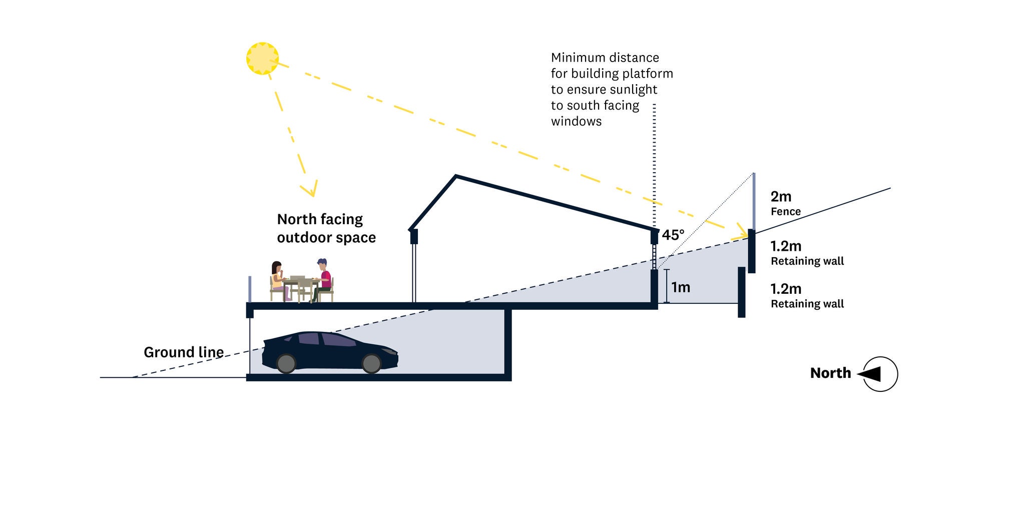
Cross sections illustrating dwelling set away from retaining wall, with outdoor spaces to the front and rear.
Well-designed development works with existing topography and minimises earth working and the need for retaining structures.
2.2 Ecology and habitat
Design outcome:
Subdivisions protect and enhance the rich ecology and habitat of the natural environment.
Why do this?
Part of the unique appeal of urban Auckland is its highly valued natural environment and the wide variety of native and exotic species. While people accept that allocating rural land for urban development will bring change, this change should not lead to a permanent loss of ecosystems or habitat.
How to achieve this outcome:
- Protect important habitats by using legal mechanisms such as land covenants and consent notices, and ongoing landscaping, weed and pest control.
- Distribute densities and lot sizes carefully to protect important habitats. Subdivisions can be designed to limit people accessing areas of sensitive habitat. Natural features and less sensitive areas can be made accessible to the wider community.
- Consider how your subdivision can help to connect areas of unbroken habitat.
- Try to improve the ecology and habitat quality of a site through:
- Riparian and other planting, including street trees
- Treating land that has been contaminated
- Reducing stormwater amounts and improving stormwater quality
- Changing exotic plant cover to native plant cover (eco-sourced if possible), when relevant to the overall landscape strategy
- Pest and weed management
Ensure that enough space is provided on each parcel of land for a large tree to grow.
- Riparian and other planting, including street trees
- An ecological assessment can assist in supporting plant and animal species that are the most at risk in the location.
- Plant where they can connect with planting areas on neighbouring lots, creating space for clusters of vegetation to grow.
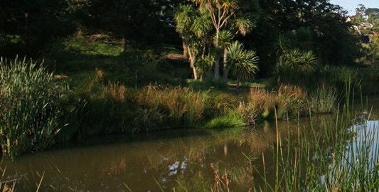
Existing and native ecologies and habitats should be protected and enhanced wherever possible. Image source: Water sensitive design for stormwater - Auckland Council. Image credit: Simon Devitt Photography.
2.3 Vegetation and landscaping
Design outcome:
Subdivisions include vegetation that enhances habitat and ecology and complements the built form.
Why do this?
Vegetation and landscaping contribute to habitat and ecology. Trees and greenery complement built form and soften what can otherwise be bland views of large- scale development. They can contribute to a sense of character and are very effective at promoting legibility and way-finding.
How to achieve this outcome:
- Provide street trees and landscaping in public spaces and streets as early as possible, to maintain continuous habitat, establish long-term amenity and character features.
- Ensure the vegetation is protected during construction.
- Try to use eco-sourced native vegetation, if it fits with the overall landscape design strategy and helps to create low-maintenance and successful planting. This will lead to the most ecologically appropriate and climate-resistant landscaping outcome possible, as well as contributing to local identity.
- Plant trees in places where they will not block high-amenity views and can grow in a balanced and healthy shape instead of needing to be shaped into an unnatural form.
- Avoid planting trees where they will need to be pruned back from overhead power lines.
- Consider concentrating street trees at the entrances to local roads in combination with measures that lower vehicle speeds, such as narrowed carriageways.
- Where road space is limited or too narrow to accommodate trees, provide street trees in the front yard of lots and protect them with legal mechanisms.
- Consider Crime Prevention Through Environmental Design (CPTED) principles when planning the location, density, and plant species use:
- Use good street lighting that will not be obscured by foliage.
- Avoid creating places where people could be trapped or taken by surprise.
- Pedestrians should be able to see where they are going and assess the risks ahead.
- Plant street trees with narrow trunks that will not make it difficult for drivers or pedestrians to see past, or that would create a place where people could be trapped.
- Use good street lighting that will not be obscured by foliage.
2.4 Stormwater and hazards
Design outcome:
Subdivisions manage stormwater and hazards by locating structures, building-platforms, and density away from vulnerable land.
Why do this?
Auckland is subject to a number of hazards. Some are natural and some are strongly influenced by human activity. Hazards include landslides, erosion, contaminated land, tsunami and tidal or storm surges, flooding, volcanic activity, earthquakes, sea-level rise and subsidence. All of these can create serious human health and safety risks that must be managed. As Auckland continues to urbanise, the risk of impervious surface-based flash flooding (where water cannot soak into the ground and is channelled by constructed barriers) is also likely to increase.
How to achieve this outcome:
- Locate building platforms away from 100-year flood plains and overland water-flow paths.
- Avoid areas that are susceptible to natural hazards, even if this means creating higher building densities and smaller lots in other places on the development site.
- Use engineering tools, such as rain gardens, tree pits, swales, detention tanks and piped networks, to manage the speed and amount of stormwater.
- Slow down the flow of stormwater and clean it on site, rather than piping it away at high speed, which can cause big disruption to stream habitats and coastal erosion.
- Use water-sensitive design and 'soft' engineering (i.e. minimise large-scale engineering structures). Where large structures are necessary, they should add amenity to the subdivision.
- Use hazard-prone and other environmentally sensitive areas to add value and outlook space to the development, rather than fencing it off, which can lower the value of adjoining sections.
- Base your decisions on life-cycle costs, not just short-term capital costs, particularly when planning infrastructure and considering stormwater management.
- Consider evacuation or escape needs if undertaking development on flood plains, overland flow paths, or tsunami-risk land.
Stormwater treatment and native planting integrated into, and a feature of the subdivision. Image credit: Candor3.
Existing and native ecologies and habitats should be protected and enhanced wherever possible. Image source: Water sensitive design for stormwater - Auckland Council. Image credit: Simon Devitt Photography.
2.5 Coastal environments
Design outcome:
Development along the coast is carefully planned to ensure that natural character values are maintained or enhanced.
Why do this?
Any new subdivision along Auckland’s coastline must be planned carefully, and consider any erosion and coastal characteristics. Extensive landscaping and building setbacks should be incorporated.
How to achieve this outcome:
- Emphasise public edges along the coast that protect coastal character and ensure that everyone can enjoy access.
- Maximise views and access to the coast in the design and direction of streets and open spaces, so that everyone can enjoy access and views. Have blocks that run away from the coast instead of alongside the coastal edge.
- Do not allow the coastal character to be taken over by land development, especially along cliff edges. Consider using covenants, consent notices or other methods to keep the coastal edge clear of structures. Alternatively, design narrower and deeper sections so that houses can be set further back from the coastal edge.
- Locate building platforms sufficiently back from the coastal edge so that a buffer of vegetation can maintain the coastal character and screen views of buildings. Structures should be no closer than 23m to the coastal edge, allowing 20m of esplanade reserve space and three metres for a typical rear or front yard.
- Decks or platforms extending beyond this should be planned very carefully to avoid creating shadow beneath the surface and to withstand coastal conditions.
- Limit retaining walls that can be seen from the coast.
- Use palisade walls carefully by:
- Setting walls back from the coastal edge so that they are not uncovered by erosion soon after construction.
- Using a colour that matches the ground and is not a smooth texture so that the wall will not be obvious when exposed.
- Setting walls back from the coastal edge so that they are not uncovered by erosion soon after construction.
Coastal character obstructed by land development
Coastal character and access maintained alongside development
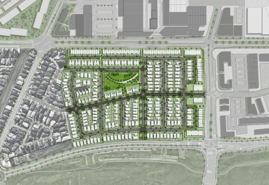
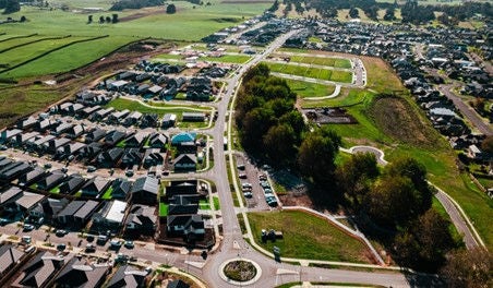
3. Movement networks
The design of roads, paths, lanes and links – the movement network – is one of the most important design decisions in creating vibrant, safe and prosperous places. The road network not only enables us to get from A to B, it defines the quality of a place by prioritising it as somewhere for people.
3.1 Connections and connectivity
Design outcome:
Subdivisions provide movement choice and connectivity, while balancing costs, safety, and privacy.
Why do this?
A connected network is based on convenient and logical connections between destinations, based on the most direct route possible. Subdivision design should allow movement that maximises opportunities for social and economic exchange, while minimising the costs and general need for travel.
How to achieve this outcome:
- Street links should be short and direct unless this is not possible due to topography, important ecological areas or natural features.
- Camber, type and design of roads should be based on how best to integrate the subdivision successfully into the surrounding area and facilitate travel with the least effort required.
- Subdivisions should provide a choice of routes and modes of travel by having a mix of different activities within a walkable distance, minimising the number of lots served by only one route and ensuring lots that can be accessed by multiple modes including walking and cycling.
- The level of connectivity and choice of routes in subdivisions should correspond to the density and land-use mix. As density increases, so should the degree of connectivity and the number of route choices available.
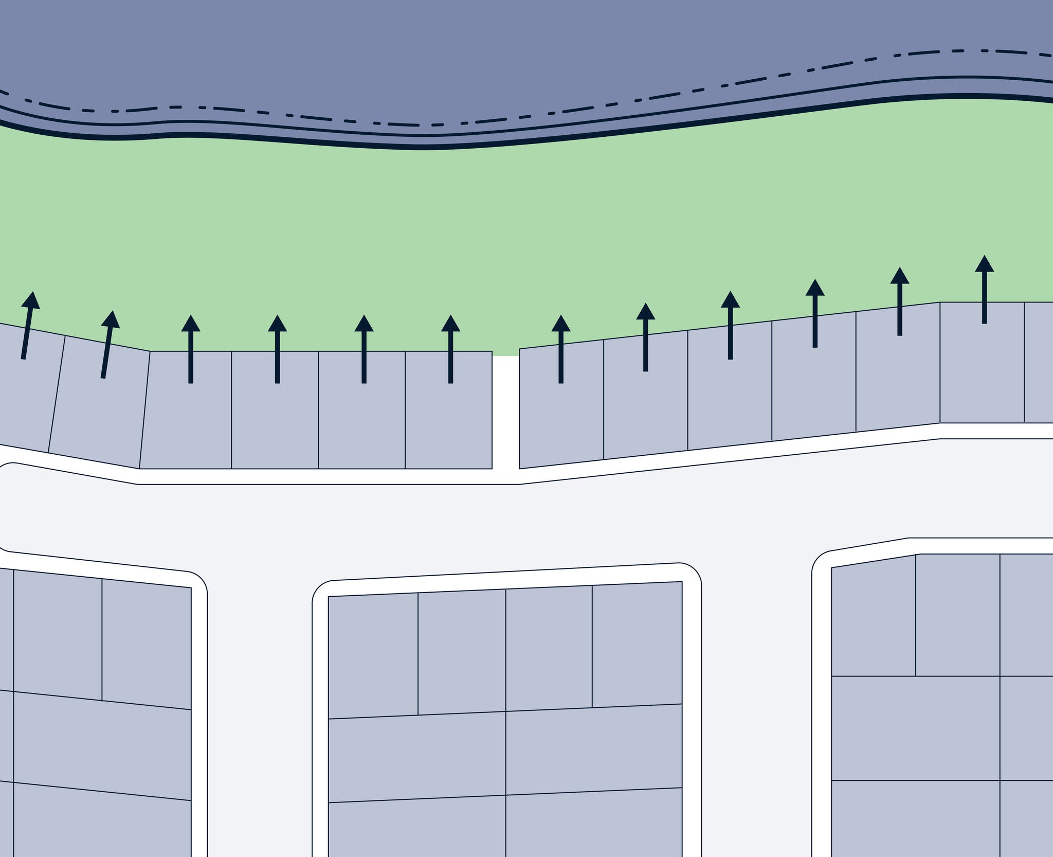
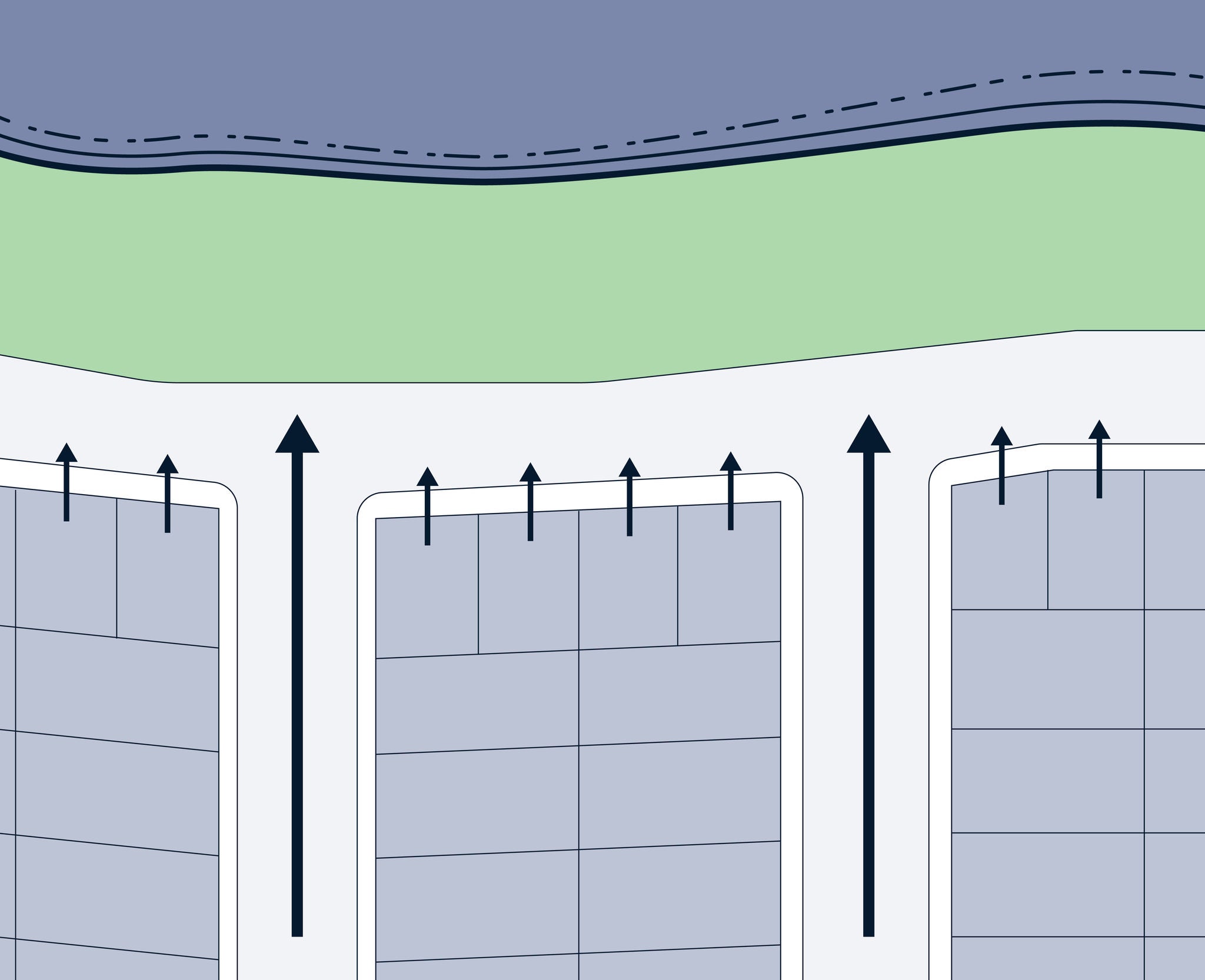
- In low density areas, where average lot sizes are larger than 1500m2 to 2000m2, limit movement networks to less than 20% of the gross land area.
- In suburban settings, where average lot sizes are less than 400m2, between 30% and 40% of the gross land area is typically allocated to movement networks.
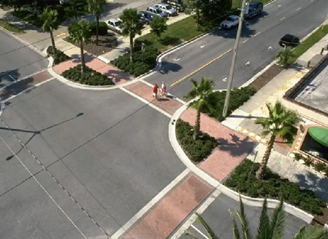
- Pedestrians should be able to cross roads comfortably without having to deviate significantly from their route to access a crossing point. The best outcome is when pedestrians can walk directly when walking from point A to point B within a subdivision, rather than having to 'double back'.
- Connected roads forming urban blocks are better than a pattern of many cul-de-sacs and a few through roads. Limit the use of cul-de-sacs to when:
- The topography stops a workable road connection being made.
- A connected road would lead to an unavoidable and significantly adverse landform or habitat loss.
- A connected road would require unreasonably significant engineering structures and cost. 7. To improve pedestrian safety cul-de-sac lengths should be minimised to allow people to see from the mouth of the road to the end.
- To improve pedestrian safety cul-de-sac lengths should be minimised to allow people to see from the mouth of the road to the end.
Design the subdivision to connect to existing streets and roads and provide straightforward routes to desired destinations. Image credit: Construkt Architects – East Quarter masterplan .
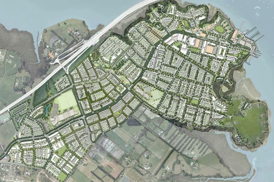
Hobsonville Point was designed as a series of different and distinct areas or “precincts”. Housing density and street type/width are key elements that contribute to the character of any area. Image credit: Construkt Architects
3.2 Walkable neighbourhoods
Design outcome:
Pedestrians are prioritised in the design of subdivisions to ensure convenience, enjoyment, and easy walking access to key destinations.
Why do this?
Walking brings direct health and lifestyle benefits to communities and reduces vehicle emissions. At some point in life everyone is limited to moving only as a pedestrian: through age, wealth, medical impairment or choice. Subdivisions, and all roads within them, must be designed to prioritise walking.
How to achieve this outcome:
- Subdivision should be very walkable, with generous footpaths and landscaped berms. Pedestrian routes should be designed to be well overlooked by property frontages, to provide passive surveillance.
- When vehicle access to lots from the street is not permitted such as along high-speed routes, lot design and buildings should ensure that buildings still face the street.
- Footpaths take precedence over vehicle crossings. Continue the gradient and material of the footpath across the top of vehicle crossings, and design transitions to maintain the levels of the footpath.
- Subdivision design should maximise the area, modes of transport, local parks and mix of activities that can be accessed from each lot within a ten-minute walk. Able-bodied adults can walk on average 800m in 10 minutes.
- Subdivision design and layout should consider how easy it is for pedestrians to access public transport routes (existing and future) and local reserves.
- Rear lots reduce walkability. Where rear lots are unavoidable, limit them to less than 10 per cent of the total number of lots in the subdivision.
- Large blocks can discourage walking as routes become too long. Reduce block sizes as the density and number of residents increases – with more people needing to access more destinations the demand for different route options increases, and smaller block sizes can facilitate this.
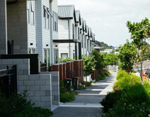
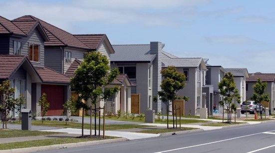
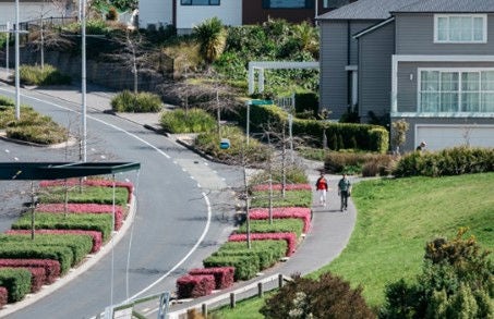
Design subdivisions to be walkable and cyclable environments. Wherever possible provide wide footpaths, carefully selected planting to berms and street trees.
Smaller block sizes facilitate walkable neighbourhoods which create amenity for residents and market appeal. Image credit: Architecture Now.
Vehicle crossings that maintain the level of the footpath promote walkable neighbourhoods. Image credit: Michael Craig for NZ Herald.
3.3 Legible hierarchies
Design outcome:
A clear and consistent road hierarchy that helps to create legible and safe subdivisions and ensure people understand how to get to, and when they are on, main routes.
Why do this?
Travel is safer, more efficient, and more comfortable when people have confidence in where they are and where they are going. A consistent approach to road design also helps to emphasise local access and residential amenity, and slow vehicles down when on local streets.
How to achieve this outcome:
- Different types of paving, street trees and vegetation should be used to inform whether a street is a local or main route. Smaller block sizes can facilitate this.
- Street layouts should be designed to be clear and easy to understand, accommodating a mix of transport types.
- Emphasise corners (including bends) with taller street trees and allow for taller buildings to contribute to way-finding and legibility.
This local street is defined by different surface treatment that encourages slow vehicle speeds. Image credit: Boffa Miskell – Long Bay residential development.
A clear and consistent road hierarchy helps to create safe and legible neighbourhoods. Image: Kōtuitui Stage 2 Manukau Crosson Architects.
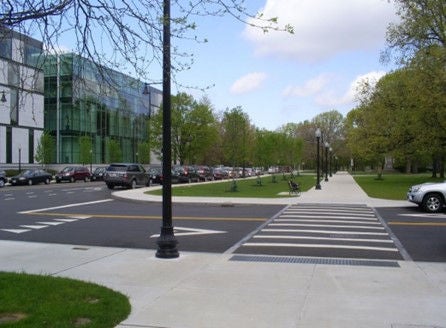
3.4 Safety for pedestrians and cyclists
Design outcome:
Subdivisions are designed to create safe and enjoyable environments for pedestrians and cyclists.
How to achieve this outcome:
- Street design, including vehicle carriageway width, street trees and vegetation, berm width, street parking, and vehicle calming measures, should provide signals of what speed a vehicle should be travelling at and provide priority and amenity for pedestrians.
- Design to achieve lower maximum speeds on all local roads, with the speed reflecting the function of the road. The lowest design speeds should be used on very quiet roads. For example 40km/h maximum speed might be appropriate on local roads, whilst a 30km/h maximum speed might be appropriate on very quiet roads.
- Traffic-calming measures can include:
- Using different materials, textures or colours to make vehicular carriageways, footpaths, cycle ways, parking bays and manoeuvring areas clearly legible.
- Tightening intersection corners to ensure slower vehicle movements.
- Incorporating islands or raised berms to help pedestrians cross and slow vehicles down.
- Avoiding long stretches of straight local residential roads by using the road reservation width to allow for regular bends or 'shifts' in the carriageway.
- Incorporating chicanes at key points to slow movement. The use of mountable kerbs can allow more space for large and emergency service vehicles incorporating landscaping into parking bays to help make the carriageway seem narrower to drivers.
- Developing tables (large, flat speed humps) with material differentiation to aid pedestrians crossing without relying on formal crossing points.
- Raising intersections and using different materials to make these points more prominent, while helping to slow vehicles down.
- Speed bumps or humps are the least desirable form of intervention for traffic calming.
- Vehicle crossings over footpaths should be at the same level as the footpath to ensure pedestrian priority, as narrow as possible to reduce vehicle entry and exit speeds, and limited in number and width to ensure sufficient space for street trees and greening. Design higher-density subdivisions carefully to avoid a high number of vehicle crossings passing over the footpath.
- Provide safe and logical crossing points and easy routes that directly follow pedestrian desire lines to make it easy, safe and enjoyable to walk throughout the neighbourhood and to local amenities.
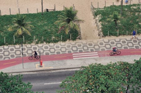
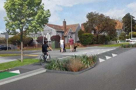
- Consider having separate cycle lanes on appropriate roads, where there are high vehicle speeds and where there is the opportunity for creating a connected network of cycling infrastructure. These can be either 'on road' next to the vehicle travel lane or 'off road' next to the footpath. Where the vehicle speed is lower than 40km/h, cyclists should be able to safely share the road with vehicles.
Subdivisions should be designed to create safe and enjoyable environments for pedestrians and cyclists. Wherever possible, retain existing landscape features as these enhance the local environment and provide character. Image: Auckland Council.
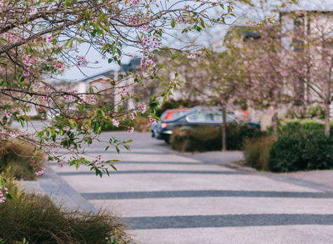
Changes in materials and colour used to clearly differentiate cycle and pedestrian routes from the carriageway
Carriageways in subdivisions should be of a sufficient width to provide either a separated cycle lane or safe on-road cycling. Image credit: Boffa Miskell – Long Bay residential development
The intersection corners are enlarged and attractively enhanced while tightening the street to slow vehicles.
Raised table in different material coupled with the use of planting, signals the entrance to this local road with a slower vehicle environment. Image credit: Artist impression for Boffa Miskell.
Pedestrian crossings should be located on pedestrian desire lines.
4. Use and activities
Successful places are those where a community can meet their daily needs within an easy walking distance. To achieve this, design decisions regarding where to locate different activities, such as shops, parks and houses, are crucial.
Subdivision design must consider where future activities will be located, and the interconnections between them. An important factor is where and at what density people will be located to support commercial, retail, community, education and public transport facilities.
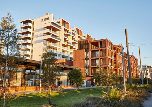
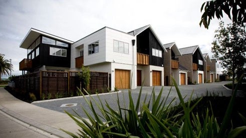
4.1 Mixed communities
Design outcome:
Subdivisions have a mix of property types, sizes, uses and activities that facilitate diversity and adaptability.
Why do this?
Subdivisions that provide for a range of different living and housing opportunities create multiple benefits including providing for housing choice, enabling people to stay in their communities as they age, and reducing the likelihood of crime due to residents being at home at different times.
How to achieve this outcome:
- Subdivision design should focus on the quality of lots, i.e. their suitability for intended use, not the number of lots.
- Subdivisions should provide for a variety of residential and non-residential land uses. Where residential is located next to commercial or industrial activities, visual and amenity buffers should be provided.
- Aim for a range of lot prices, types and sizes in all subdivisions, and ensure a range within any subdivision of 10 or more lot types. With bigger lots greater than 650m2 consider how they could be subdivided in the future, and with smaller lots, access to open space, views and outlook will be important.
4.2 Locating amenities
Design outcome:
Subdivision design locates amenities where they have maximum footfall, and visual and physical accessibility.
Why do this?
Easy access to amenities like parks, playgrounds, community facilities and shops increases the likelihood that the amenities and the routes to them will be used. This ensures that residents feel safe using the amenities and walking to them, instils a sense of community and local identity, and ensures a good return on investment in theses amenities.
How to achieve this outcome:
- Aim to have fronts of dwellings, shops and community facilities for at least two thirds of all open spaces and retained natural features, except habitat or ecological spaces not intended for recreational use or human access.
- Vehicle connections and pedestrian and cycling desires lines between important amenities and features should be created and supported through street layout and design, including through paving and greening.
- Locate amenities and exemplar developments on prominent sites such as at intersections or on sites that are highly visible.
- Integrate amenities and routes to them into the subdivision by maximising their road frontage, and planning for future land uses to overlook the amenities. Landscaping should also be used to emphasise the presence of features in the subdivision.
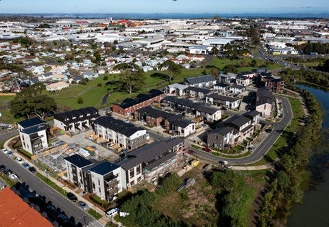
A logical and connected street layout is the key to subdivision design. It promotes legibility and ease of access to local centres and amenities. Image credit: Park Green.
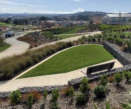
4.3 Open spaces
Design outcome:
Existing open space networks are enhanced and new open spaces provide a variety of activities for different uses.
Why do this?
Large fields allow for informal and organised sports play, smaller and more intimate areas allow neighbours to meet and supervise children’s play, while longer and varied spaces connect places and provide for recreational walks.
How to achieve this outcome:
- Identify and assess the quality of existing open spaces and publicly accessible areas in the surrounding area before designing new spaces within the subdivision.
- Consider the type of open spaces and recreational activities that will benefit future residents the most.
- Try to physically connect to, expand on or compliment existing open space networks, rather than creating similar open spaces to those that already exist.
- Locate public open spaces for recreation on flat, usable land in accessible and obvious locations. Locate public open spaces for ecological or habitat protection so that they can be seen by people, but are not exposed to interference.
- Streets should be designed as part of the public realm where people can meet, congregate, move and linger.
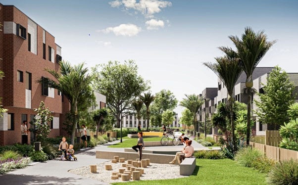
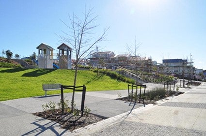
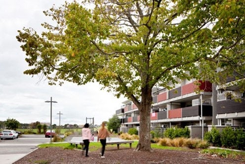
Open spaces designed in to subdivisions provide amenity, build a sense of community and add value. Design open spaces within developments that will suit the intended demographic. Image credit: Crosson Architects Wirihana.
5. Urban structure and identity
Subdivision design can impact matters such as privacy, views, access to sunlight, street amenity and overall identity and character.
5.1 Fronts and backs
Design outcome:
Subdivision design carefully manages the difference between public and private space so that ownership is clear at all times.
Why do this?
People take more pride and responsibility for land that is their own. With successful design, this sense of ownership can extend to adjoining sites, the street, and open spaces.
How to achieve this outcome:
- Lots should be designed to have an obvious public ‘front’ that faces the street or public space, and a private ‘back’ facing other ‘backs’. Other than corner lots, lots should enjoy three private edges.=
- Public fronts should not sit next to private backs unless there are major access issues or large spaces separating them such as dense bush.
- Common private space, including any private roads or lanes, should be treated as public space for the purposes of applying the fronts and backs principle.
- Dedicated rear lanes for higher density development sites should be thought of as a back space, but should be secure and free from general public access.
- Consider whether the target demographic of the subdivision will prefer privately owned space, common space or publicly owned space.
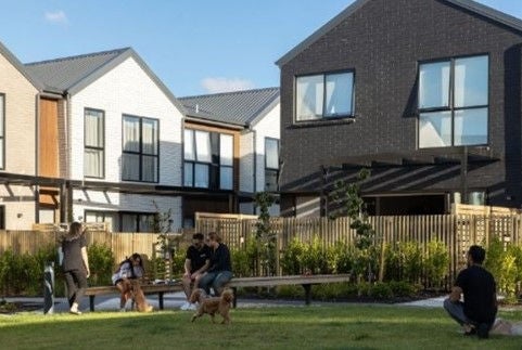
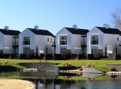
Public fronts face and overlook this common outdoor space. Privacy for residents is maintained by way of semi-permeable fencing. Image credit: Richmond Development.
The Richmond Development in Mt Wellington, Auckland has been well planned with public fronts facing streets and private outdoor living spaces located at the rear. Image credit: Richmond Auckland.
5.2 Orientation and outlook
Design outcome:
Subdivisions are carefully planned relative to slope and orientation to maximise sunshine, views and privacy.
How to achieve this outcome:
- Density should be focussed where residents can benefit from views and outlook. Where a high quality view exists, fronts and backs should be carefully managed between lots so that future development will not impact upon privacy. Consider imposing development controls on the building platforms of lots that may block the views of lots behind.
- For example:
- Requiring development on a section fronting the coast to be within a certain height or RL (‘reduced level’) limit, so that development on a lot behind can see out above it.
- Requiring development on a lot to follow a contour so as to maintain the form of a prominent ridge or landform.
- Plan lots so that vehicle access is not on the northern edge of a site, which can stop sunshine from reaching habitable rooms. Sites facing east or west can have vehicle crossings and building platforms specified on the southern side, leaving the northern side clear for sunny outdoor living.
- Design lots to get the most sunshine possible. Sunny private spaces should be located away from public spaces and streets so that if residents put up large walls / fences for privacy it does not impact upon the street.
- Lot shapes should be varied in shape and size, to benefit from maximum sunshine in relation to their orientation.
- For example:
- Sites facing south can be narrower and deeper, which means a house in front and a north-facing outdoor living area behind.
- Sites facing north can be wider and shallower, which means a house and an outdoor area can sit side-by-side and enjoy a good aspect.
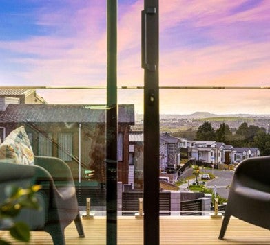
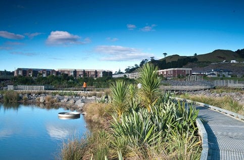
Plan and design subdivisions on sloping land so that the maximum number of sites receive views and sun. Image credit: Homes.co.nz Bremner Ridge.
5.3 Character and identity
Design outcome:
Subdivisions exhibit a clear identity, character and sense of place.
Why do this?
Places with strong and coherent identities are places that people want to live and work in and create a sense of ownership and belonging for. Carefully managing design details and how developments evolve over time can contribute to how residents experience and feel about their neighbourhood. Subdivision design is a key tool in the process of creating amenity, character, and identity in new developments.
How to achieve this outcome:
- Subdivision design should use the opportunities available to make a place unique or memorable, especially if there is an historical significance, natural landform feature, or significant experiences such as a rare view.
- The identity and character of a subdivision should be informed by local landform and landscape character. Physical and ecological features on the site, including significant trees, should be retained or enhanced.
- Subdivisions should allow for future landmarks, including iconic buildings and landmarks, to establish over time. Bold statements of character should be made at subdivision entry points.
- Residents should get a strong sense of identity and community from the layout, amenities and integration of the subdivision with the wider neighbourhood. Subdivisions should integrate successfully into their wider neighbourhoods through:
- Road connections and urban structure.
- Design cues, such as block sizes and sizes and shapes of sections, that refer to historical or adjacent developments.
- Providing new amenities that complement adjacent ones rather than duplicating them.
- Continuing any established themes such as paving styles and planting types using the new subdivision to improve the wider area, e.g. opening up a more convenient road or route through the subdivision.
- Aim to use distinctive street trees, paving materials, road and place names and street furniture to complement the sense of place.
Character is provided in this subdivision by respecting and working with the site’s existing topography. Character is further enhanced by sensitive hard and soft landscaping. Image credit: Greenwood Associates Landscape Architects.
Identity and character can be created or enhanced by referencing adjacent buildings, providing services and amenities that complement existing ones and by continuing or complementing existing hard and soft landscaping including streetscape materials.
Retaining existing mature trees provides character to an otherwise standard subdivision. Image credit: CKL NZ.
5.4 Vehicle access
Design outcome:
Subdivision design incorporates vehicle access that supports street amenity and pedestrian safety.
How to achieve this outcome:
- Street and block design should avoid a prevalence of garages dominating the public street environment, by incorporating rear lanes and parking courts where possible.
- Lots should be designed so that vehicle access does not result in footpaths undermined by the presence of too many vehicle crossings or wide, sweeping vehicle crossings that allow cars to cross the footpath at very high speeds.
- Consider planning lots to have shared vehicle access to minimise disruption to the street’s amenity.
- Consider imposing requirements on how close to street trees a vehicle crossing can be to remove future problems with root growth damaging driveways and demand for tree removal by residents.
- Include details on the subdivision landscape plan of street trees, on-street parking bays and locations where vehicle access into sites could be provided without conflicting with street trees or parking bays.
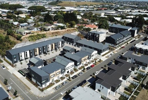
The dwellings have been designed with the rear of the units, including car access and garages facing a rear access lane. Main living spaces and dwelling fronts enjoy views and sun. Image credit: Dean Purcell for NZ Herald.